Monthly Archives: October 2014

A document for stream data used in DHSVM

Zhuotong Nan (南卓铜, [email protected])

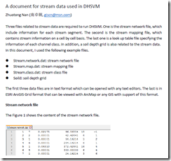
Three files related to stream data are required to run DHSVM. One is the stream network file, which include information for each stream segment. The second is the stream mapping file, which contains stream information on a cell by cell basis. The last one is a look up table file specifying the information of each channel class. In addition, a soil depth grid is also related to the stream data.

In this document, I used the following example files.

  • Stream.network.dat: stream network file
  • Stream.map.dat: stream mapping file
  • Stream.class.dat: stream class file
  • Soild: soil depth grid

The first three data files are in text format which can be opened with any text editors. The last is in ESRI ArcGIS Grid format that can be viewed with ArcMap or any GIS with support of this format.

See the 7-page document for details.

image

pdf, 186KB

Workflow of Preparing Stream Data for DHSVM

Workflow of Preparing Stream Data for DHSVM

Zhuotong Nan (南卓铜, [email protected])

Preparing stream data for DHSVM is very complicated. Many AML scripts as well as Java are involved. Through the example showed below, I want to examine what the preparation really does and what happens behind the scripts. The scripts need ArcGIS workstation, which is not commonly installed. Thus I wrote this article, in the hope that without installation of ArcGIS workstation, you can see clearly the processes and if you want you can re-implement it with other languages.

I created a folder named “highplandpark” on the desktop, whose actual path is c:usersnztdesktophighlandpark. The contents in this folder include,

  • Arcscripts, directory, the aml scripts copied from DHSVM.
  • Programs, directory, the java codes copied from DHSVM
  • Dembuilding_my.asc, file, dem file
  • Mask.asc, file, the mask file for the area of interest

Those files can be found here.

In order to repeat the following steps, ArcGIS Desktop and Workstation, Java Runtime Environment JRE, shall be installed as prerequisites. I used version 10.0 for both ArcGIS Desktop and Workstation and JRE 7. My OS is Windows 7 x64.

image
Generated soil depth grid

Read the 18-page full document, pdf (478KB)

Two attached files

奇虎360 google字体的问题

因为google font被国内封掉,使用360的代替google fonts (fonts.useso.com),详细见此帖子,但在chrome里总出现错误,导致google字体无法在后台显示。比如在是在,

http://nanzt.info/wp-admin/plugins.php?activate=true&plugin_status=all&paged=1&s=

出现 Cross-origin Resource Sharing Policy的问题,如图所示。

882516f0aa11711ce50d8907fc19b6ec


但如果切换成google fonts 的原始网址(fonts.googleapis.com),则没有这个问题,后台正常显示字体。

以上问题在ie里不出现。

这应该是 360本身的问题。强迫不管http还是https均使用科大的google字体,在 USESO_TAKE_OVER_GOOGLE插件的代码里做了如下简单修改。以上问题得到解决。

function useso_take_over_google_str_handler($matches)

{

$str = $matches[0];

/*if (!is_ssl()) {

$str = str_ireplace(‘//fonts.googleapis.com/’, ‘//fonts.useso.com/’, $str);

$str = str_ireplace(‘//ajax.googleapis.com/’, ‘//ajax.useso.com/’, $str);

} else {*/

$str = str_ireplace(‘//fonts.googleapis.com/’, ‘//fonts.lug.ustc.edu.cn/’, $str);

$str = str_ireplace(‘//ajax.googleapis.com/’, ‘//ajax.lug.ustc.edu.cn/’, $str);

/*}*/

return $str;

}