转自宋基会嘉公益
原文:https://mp.weixin.qq.com/s/UNLXxEaigNWjYSlut_dr6Q (音频版)
作者:赵淑萍、南昭瑾
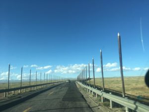
当你坐着火车沿着这条神奇的天路在青藏高原穿行时,你可能会发现铁路边上有很多稀奇古怪的东西。比如,铁路路基边上铺着碎石块、路基里面埋着管子、路上搭着蓝色的小棚子,路两边还插着一排排的杆子。
转自宋基会嘉公益 原文:https://mp.weixin.qq.com/s/UNLXxEaigNWjYSlut_dr6Q (音频版) 作者:赵淑萍、南昭瑾
当你坐着火车沿着这条神奇的天路在青藏高原穿行时,你可能会发现铁路边上有很多稀奇古怪的东西。比如,铁路路基边上铺着碎石块、路基里面埋着管子、路上搭着蓝色的小棚子,路两边还插着一排排的杆子。
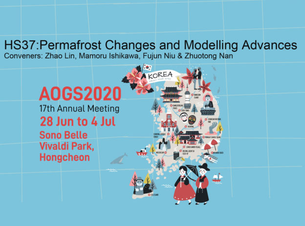
欢迎同行参加AOGS2020,HS37: 多年冻土变化及建模进展,召集人赵林教授。
摘要截止: 2020年1月21日。摘要提交需要登录MARS系统。
期盼相聚韩国洪川、畅谈冻土进展。
AOGS2020, HS37:Permafrost Changes and Modelling Advances, Conveners: Zhao Lin, Mamoru Ishikawa, Fujun Niu & Zhuotong Nan.
Abstract submission due: Jan 21, 2020
While climate models project strong future warming, continuous changes in permafrost will have major impact on the Earth system, affecting climate system, water cycle and carbon cycle. There is an urgent need to understand the nature of the change of permafrost dynamics in response to climate change. It is therefore timely for a session to bring together studies that address recent advances in understanding, diagnosis and prediction of past and future changes in permafrost regions in Asia as well as improvements in numerical permafrost modelling.
28 Jun to 4 Jul 2020, Sono Belle Vivaldi Park, Hongcheon.
被誉为世界“第三极”的青藏高原是全球中低纬度地区海拔最高、面积最大的多年冻土区,被称为全球变化的“驱动机”和“放大器”。过去50年青藏高原变暖趋势明显,导致多年冻土发生显著退化,进而严重影响到区域水文、生态乃至全球气候系统。近30年高原变暖速率显著增加,且冬季变暖速率快于夏季变暖。这就引发了一个重要的科学问题,即冬季变暖如何影响整个高原多年冻土的变化。然而,迄今为止,尚未有研究评估多年冻土对冬季变暖的响应。
针对上述科学问题,我们以数值实验为手段,首次研究了青藏高原冬季变暖对多年冻土的影响,结果表明:
该研究通过假设数值实验首次研究了冬季变暖对多年冻土变化的影响,为理解青藏高原多年冻土对季节性变暖的响应提供了一个新的视角。
Continue readingWu X, Nan Z*, Zhao S, Zhao L, Cheng G. Spatial modelling of permafrost distribution and properties on the Qinghai-Tibet Plateau. Permafrost and Periglacial Processes. 2018,(1-14). DOI:10.1002/ppp.1971.
Link: http://onlinelibrary.wiley.com/doi/10.1002/ppp.1971/pdf
下载: Baidu Cloud
Zhao S, Nan Z*, Huang Y, Zhao L. The application and evaluation of simple permafrost distribution models on the Qinghai-Tibet Plateau. Permafrost and Periglacial Processes. 2017, 28(2): 391-404. DOI:10.1002/ppp.1939.
ABSTRACT
The performance of simple permafrost distribution models widely used on the Qinghai–Tibet Plateau (QTP) has not been fully evaluated. In this study, two empirical models (the elevation model and mean annual ground temperature model) and three semi-physical models (the surface frost number model, the temperature at the top of permafrost model and the Kudryavtsev model) were investigated. The simulation results from the models were compared to each other and validated against existing permafrost maps of the entire QTP and in three representative areas investigated in the field. The models generally overestimated permafrost distribution in the investigated areas, but they captured the broad characteristics of permafrost distribution on the entire QTP, and performed best in areas with colder, continuous permafrost. Large variations in performance occurred at elevations of 3800–4500 m asl and in areas with thermally unstable permafrost. The two empirical models performed best in areas where permafrost is strongly controlled by elevation, such as eastern QTP. In contrast, the three semi-physical models were better in southern island permafrost areas with relatively flat terrain, where local factors considerably impact the distribution of permafrost. Model performance could be enhanced by explicitly considering the effects of elevation zones and regional conditions.
Links: Baidu;
马启民,黄滢冰,南卓铜*,吴小波. 青藏高原典型多年冻土区的一维水热过程模拟研究. 冰川冻土. 2016, 38(2): 341-350.
摘要:
了解多年冻土内部的水热过程对寒区工程规划和建设的辅助决策具有重要意义。冻土的水分迁移与温度变化密切相关,然而传统的经验模型局限性大,对水热物理过程考虑不足;陆面过程模型所需的驱动数据多且很难准确模拟深层土温,尽管数值模型在工程上应用的比较多,但很少应用到冻土的演化过程中。基于非饱和土壤渗流和热传导理论,实现了冻土水分场与温度场的水热耦合数值模拟。以唐古拉综合观测场为例,将数值模拟结果与观测数据进行对比,验证水热耦合数值模拟的有效性。结果表明:模型对土壤温度模拟效果较好,15 m以上R2在0.88以上,RMSE在1℃以内;水分模拟尚可,但仍存在一定误差,R2在0.7以上,RMSE在7.65%以内。模拟的活动层厚度约3.6 m,年平均地温所在的深度约为15 m,与实测值基本一致。该水热耦合模型可用于研究多年冻土区土壤水热变化规律.
下载 (pdf, ~10.8 MB): mqm.et al. bcdt.2016
科技部基础性工作“青藏高原多年冻土本底调查”的重要成果,已经通过科学出版社出版出来了。
赵林, 盛煜, 南卓铜 et al., 2015. 多年冻土调查手册. 北京: 科学出版社, 198.
[1] Nan Z, Huang P, Zhao L. Permafrost distribution modeling and depth estimation in the West Qinghai-Tibet plateau[J]. Acta Geographica Sinica. 2013, 68(3): 318—327.[南卓铜,黄培培,赵林. 青藏高原西部区域多年冻土分布模拟及其下限估算[J]. 地理学报. 2013, 68(3): 318—327.]
4.22MB, pdf