Tag Archives: lst

最近的两个论文

  • Hu J#, Zhao S#, Nan Z*, Wu X, Sun X. A novel approach for mapping permafrost in a large  area using subregion maps and satellite data. Permafrost and Periglacial Processes. 2020,  31(4): 548-560. 

我们发展了一个利用区域调查图来制作大区域冻土分布图的方法,输入包括遥感地表温度、土壤类型等数据。详细介绍见:https://permalab.science/frostnum-cop-permafrost-mapping-method.html

  • Chen Y, Nan Z*, Zhao S, Xu Y. A Bayesian approach for interpolating clear-sky MODIS  land surface temperatures on areas with extensive missing data. IEEE Journal of Selected  Topics in Applied Earth Observations and Remote Sensing. 2020, 14: 515-528.  

我们在Yu et al. 2015的基础上,发展了一种利用时序上邻近的多个影像对缺失的地表温度进行晴空等效地表温度插值的方法。详细介绍见:https://permalab.science/modis-jstars-2020.html
一个批量将MODIS LST HDF转换为GeoTIFF的工具 v1.02

功能:

  1. 批量转换MODIS地表温度数据(LST)的HDF到GeoTIFF格式
  2. 支持多tiles的mosaic
  3. 支持剪裁(目前只支持指定矩形范围)
  4. 输出指定变量(白天晚上的LST、质量控制、观测时间共6个变量中的若干个)

当前版本 1.02

下载地址见文末。任何问题请向giscn(at)msn.com 报告。 Continue reading

一种简单有效的MODIS LST内插方法

一种简单有效的MODIS LST内插方法

Zhuotong Nan ([email protected], 南卓铜)

本软件实现了一种新的基于相似性原理的MODIS陆表温度(LST)的插值方法。这种LST数据空间插值方法利用具有相似温度变化特征的已知LST像元集合推算缺失的LST。在青藏高原的案例表明传统的地统计方法基本无法处理大范围连续的数据丢失(比如因为云),而本方法明显优于传统方法,可能较合理的得到缺失LST。此方法尤其适用于大范围山地区域。

This tool implements a new interpolation method for MODIS land surface temperature (LST) following the theory of similarity. It estimates the missing LST pixels by known LST pixel sets which bear similar characteristics of LST variation as the missing pixels. A case study on the Qinghai Tibet plateau has already been carried out, showing its obvious advantages over the traditional geostatistic methods, the latter was unable to do with a large area and temporally continuous data missing situations. This approach is especially good for a study area with a large area and mountainous terrain.

6704d1efb515c7a26d93914d72b14448

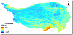
fig 1a, with this approach

315bdc690406652281a46f305a2e6697

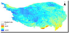
fig 1b, with Kriging

Continue reading